Zentech Extend Reality Engineering
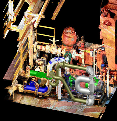
 Point Cloud Data: A set of data points in space. The points represent a 3D shape or object. Each point has its set of X, Y, and Z coordinates.
 - Data capture (even in no lighting environments) within +/- 1 – 2mm accuracy.
- Ability to accurately create, modify or compare 2D drawings and 3D models by overlaying Point Cloud data.
- Maximizes integration to review onboard state with design and engineering teams by exploring spaces in a 360 environment from their own computers.
ZXR-E Samples:

 Point Cloud Data: A set of data points in space. The points represent a 3D shape or object. Each point has its set of X, Y, and Z coordinates.